Historical working map
Specialty layers and practice footprint
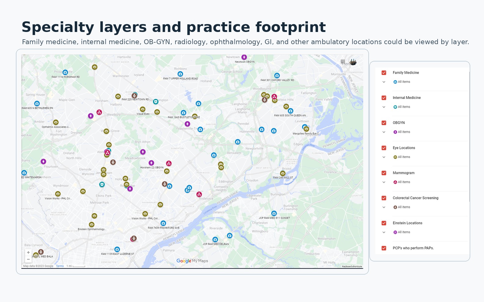
A preserved Jefferson Maps view of practice locations and specialty layers used during population-health outreach. It contains no patient records.
Provenance
Cole Lyons assembled and structured the location data from practice-directory spreadsheets and public Jefferson location information, then created and maintained the map with Google Maps/My Maps and QGIS-created overlays.
Version
Preserved 2023 working-map view; publication date May 31, 2026.
What the artifact shows
The map places practice pins across the Philadelphia region and keeps the entire service-line legend visible beside them. The legend separates family medicine, internal medicine, OB-GYN, eye locations, mammography, colorectal cancer screening, Einstein locations, and locations where primary-care clinicians performed Pap services. Several specialties can appear at the same address, so the layer uses distinct colors and markers instead of collapsing a site into one generic pin.
The artifact demonstrates the operating value of a shared location layer. Staff could scan the network by specialty and geography while a patient was still on the call, then use the official location details and their operating knowledge to discuss a practical next option. It does not contain patient-level data or establish current location availability.